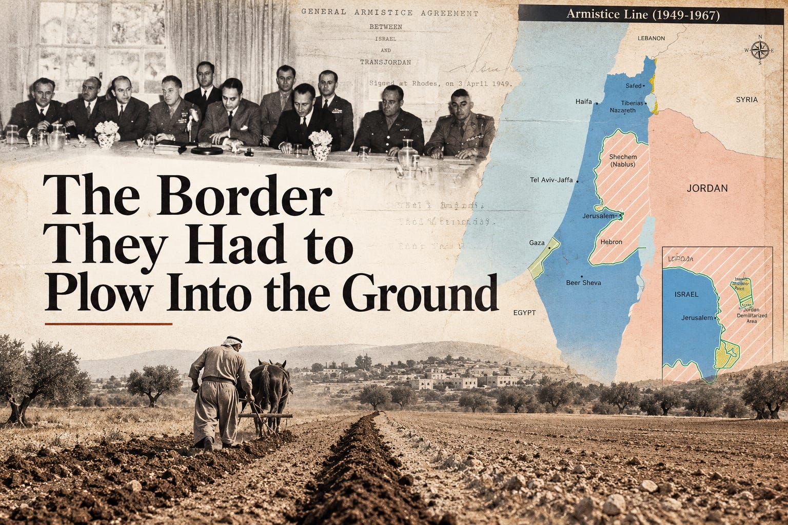
You hear about the “1967 borders” con.stant.ly. Israel should withdraw to them. Israeli settlements sit beyond them. A future Palestinian state should be built around them. Blah. Blah. Blah. We talk about this line * so often* that it could be easily mistaken for an
That’s a negative. There absolutely wasn’t.
The line had been drawn in 1949…eighteen years before the Six-Day War, and Palestine wasn’t sitting on the other side of it. Jordan controlled the West Bank and East Jerusalem. Gaza was under Egyptian control.
It came out of the 1948 war. Once the fighting ended, Israel negotiated armistice agreements with the Arab countries it had just fought, including Jordan. Their agreement was signed on April 3, 1949. The line separating Israeli and Jordanian forces became what we now call the Green Line.
And the agreement is crystal clear about what that line meant. Its provisions were “dictated exclusively by military considerations.” The Armistice Demarcation Lines were drawn “without prejudice to future territorial settlements or boundary lines.” This was about where the armies would stop after the war. Permanent borders were still an open question.
The men who drew that line? They said exactly what it was…for separating armies after a war. What they weren’t doing was establishing a permanent border between Israel and any type of Palestinian state that might eventually emerge.
And yet here we are. We’ve spent decades talking about the “1967 borders” as if there was once a recognized border between Israel and Palestine, Israel crossed it in 1967, and everything on the other side was part of a Palestinian country that had existed there before the war.
That...isn’t even close to what really happened.
There’s another part of the Green Line story that gets almost no attention: how they actually put it on the ground.
For that, the clock stays between 1949 and 1952. No Six-Day War. No Oslo. No settlements built decades later. During those first few years, Israel, Jordan, and UN observers were still trying to turn the armistice maps into something people could identify while standing in a field.
Sometimes they couldn’t.
When the armistice agreement was signed on April 3, the Green Line didn’t magically appear across the landscape.
For starters, there were still Iraqi troops in the territory. Iraq hadn’t signed an armistice with Israel at all. Jordan had, so part of the deal was that Jordanian troops would move in and replace the Iraqis. Even that took time. Depending on the area, the agreement allowed anywhere from five to fifteen weeks to get it done.
There was also the small matter of where the line would actually go.
Around Hebron and the Dead Sea, it was shifted in Jordan’s favor to make up for changes elsewhere that favored Israel. Near Tulkarm and Qalqilya, the new line created a problem with the existing road, so Israel agreed to pay for 12.5 miles of new road for Jordan.
And people lived here. They had homes, fields, and animals. The agreement included provisions protecting the residence and property rights of villagers affected by the changes. Anyone who decided to leave was allowed to take livestock and movable belongings with them.
None of that fits very neatly inside a green line on a map.
On the ground there were villages, roads, farms, grazing land, and people who needed to know which side they were standing on.
That part still had to be figured out.
The UN had quite a job ahead of it. Its observers were responsible for “the drawing and controlling of some 500 kilometres of demarcation lines.”
That’s about 310 miles, and much of it had to be worked out on the ground. Observers traveled by jeep and on foot, stopping in villages and talking with the people who lived there. For one fifteen-week stretch, the UN reported that they were putting in sixteen-hour days.
For the most part, Israel and Jordan managed to make the changes without another round of fighting. The UN said the work had been carried out “satisfactorily and without serious incidents” and credited both sides for cooperating.
But the problems they were finding weren’t small. Some people had been cut off from the fields they farmed, the water they used, or the land where they grazed their animals. There were still strips of no man’s land left over from the war. Even in Jerusalem, months after the agreement was signed, Israel and Jordan were still trying to replace the areas of no man’s land with a single demarcation line.
And…there was another problem they kept running into…
The maps.